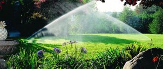
Definition of reclamation
Land reclamation is a set of measures that can be used to increase land productivity. This is achieved with the help of special economic, technical and organizational manipulations. Accordingly, a land reclamation specialist is a person who performs similar work. A set of measures, for example, can be aimed at the general improvement of soil that has become heavily oxidized.
It is noteworthy that reclamation measures are carried out not only in industrial gardening, but also by amateurs - owners of summer cottages and personal plots.
Land reclamation in Russia
In Russia, from 2014 to 2021, there is a federal program for land reclamation, which includes all types of reclamation. Aimed at returning abandoned farmland to circulation and improving the areas used to ensure the country's food security.
Types of reclamation soils include depleted soils of the southern zone, uncultivated farmland of the middle zone, unused fields of the northern regions (Vologda, Arkhangelsk regions, Karelia).
Soil amelioration
This is the most popular type of reclamation measures . It is used both by ordinary summer residents and on an industrial scale. Hydro reclamation helps improve the condition of the earth using air or water. This procedure is mainly used to treat areas that are too dry, eroded and waterlogged. The most popular types of hydromelioration are anti-mudflow, anti-flood, irrigation and drainage works. The wide popularity of this direction is determined by the availability of the resources used. In particular, air, heat and water are the main elements that determine soil quality.
Features of agroforestry
Such activities involve the use of water-regulating and soil-protective qualities of forests. In simple terms, the goal of agroforestry is to create barriers for protection. For example, anti-erosion reclamation is intended to protect the land from erosion processes using forest plantings. In such a situation, trees are planted along river banks and in ravines and pits. Another direction is field protection work, which is designed to protect the soil from technogenic, natural and anthropogenic factors.
Types and types of reclamation
1. irrigation and drainage:
- irrigation,
- drainage,
- flood control,
- anti-mudflow,
- anti-erosion,
- anti-landslide
2. agroforestry;
- anti-erosion - protecting land from erosion by creating forest plantations on ravines, ravines, sand, river banks and other areas;
- field protection - protection of lands from the effects of adverse phenomena of natural, anthropogenic and man-made origin by creating protective forest plantations along the borders of agricultural lands;
- pasture protection - preventing degradation of pasture lands by creating protective forest plantations
3. cultural and technical reclamation;
- clearing reclaimed lands from woody and herbaceous vegetation, hummocks, stumps and moss;
- clearing reclaimed lands of stones and other objects;
- reclamation treatment of solonetzes;
- loosening, sanding, claying, earthing, planting and primary tillage;
- carrying out other cultural and technical works.
4. chemical reclamation.
- liming,
- phosphorite treatment,
- plaster casting
The choice of type of reclamation depends on the natural and economic conditions of the territory; As a rule, a complex of reclamation measures is used. An example is the Land Improvement project, carried out in Uzbekistan.
| This section is missing references to information sources. Information must be verifiable, otherwise it may be questioned and deleted. You may edit this article to include links to authoritative sources. This mark was set on November 16, 2021 . |
Chemical and thermal reclamation
Thanks to the use of special means, the composition of the soil improves. These measures are intended to treat initially unsuitable or unsuitable soil. Chemical reclamation removes substances harmful to plants from the soil. At the same time, the earth is saturated with useful chemical compounds. This reclamation has several subtypes :
- sourness;
- liming;
- plaster casting
Lime is added to fertilize chernozem soil. Gypsum-based additives are used to reduce the alkalinity of the earth. Acidification is much less common and is mainly used for growing various types of tea.
Thermal technology is more likely to be a seasonal method, since it is used mainly in winter. The goal is to warm the soil. Before the frost season, measures are taken to increase the temperature of the surface and deep soil layers so that the root system of trees and other plants is reliably protected from frost. This can be achieved using different methods.
One of the most common options is adding mineral soil . The classic method of thermal reclamation is mulching, which involves spreading compost on the surface. This is the simplest solution. Fallen leaves, shavings, sawdust and other waste are taken as raw materials.
Cultural and technical reclamation measures
This type of treatment is considered superficial because it does not involve changing the composition and structure of the soil. All procedures are aimed at removing foreign objects from the soil. It can be :
- stumps;
- stones;
- weeds and other objects.
Cleaning is done manually or using special equipment. For example, cultural and technical reclamation measures involve sanding and loosening with motor cultivators. This treatment increases the soil's resistance to pests and provides it with protection from the growth of weeds.
Nuances of forest reclamation
The use of forests can also be used as a separate method of land reclamation. The bottom line is that natural and artificial forests perfectly regulate water flows. Therefore, the soil in forests is characterized by high resistance to erosion processes. This property is very important for many areas of agriculture where a water regulating element is required. Forest reclamation can be called an additional factor that makes it possible to create a permanent hydraulic environment for the land .
Final advice
Land reclamation work is not as simple as it seems at first glance, so we recommend that you involve specialists in this field or work under their strict guidance. After all, each task requires not only certain equipment, tools, materials, but also specific knowledge, skills and experience.
The result of the work carried out will be a garden plot that will not only be highly productive, but will also become the best place for a good rest for you and your loved ones.
Technology selection
There are a lot of nuances on which the use of one or another type of soil reclamation depends . One of the main selection criteria is the condition of the land. For example, liming and oxidation are carried out only in situations where the soil needs restoration and additional nutrition due to an imbalanced chemical balance. That is, the types of reclamation measures are selected depending on the current situation.
External factors are no less important - climatic conditions or the presence of a forest nearby can also adjust or expand the choice. In addition, the type of cultivated plants that require certain soil indicators is taken into account.
All types of land reclamation cannot be called a novelty for the agricultural sector. This is one of the oldest works of a man who, even in ancient times, valued fertile land. It’s a completely different matter that modern technologies make it possible to increase the efficiency of land reclamation with the help of special equipment and tools.
For example, using high-performance units, agricultural workers carry out cultivation, irrigation, fertilization, chemical treatment and many other activities. But folk reclamation means are not forgotten, including clearing, loosening, mulching and other types of soil treatment and protection.
SECTION 1. TYPES OF RECLAMATION. WATER REGIME OF SOIL.
SECTION 1. TYPES OF RECLAMATION. WATER REGIME OF SOIL.
TECHNOLOGY FOR REGULATING THE WATER REGIME OF SOIL
Types of land reclamation
The word “melioration” comes from the Latin word melioratio, which translated into Russian means improvement. In the modern concept, reclamation is a system of organizational, economic and technical measures aimed at radical improvement of land in order to create the most favorable conditions for the development of agriculture or the general improvement of the area.
Based on the impact on soil and plants, there are different types of reclamation : hydraulic, agrotechnical, forestry, chemical and cultural.
and etc.
The most significant impact on improving natural conditions is exerted by agricultural hydrotechnical reclamation (irrigation, watering and drainage), which changes the water-air regime of the soil.
Agrotechnical reclamation leads to changes in the content of various nutrients in the soil and ultimately ensures an increase in its fertility.
Agrotechnical reclamation includes the correct choice of depth and direction of plowing, soil deepening, grassing of steep slopes, improvement of meadows and pastures, and snow retention.
Forestry reclamation refers to the improvement of land by growing woody or herbaceous vegetation in combination with woody vegetation. This includes afforestation of the area, consolidation of moving sands, creation of shelterbelts, etc.
During chemical reclamation , to improve lands, especially saline ones, gypsum, lime, sulfuric acid, defecation mud, phosphate rock, etc. are added to the soil. Chemical reclamation includes the use of various herbicides to combat the overgrowth of reclamation canals, the use of polymers to reduce filtration losses of water from reservoirs and canals.
Cultural-technical reclamation makes it possible to improve the condition of the soil surface by removing stones, stumps, bushes, and leveling the surface.
The objects of agricultural reclamation can be lands: with unfavorable water-air conditions (swamps and wetlands, arid steppes, semi-deserts and deserts); with unfavorable physical and chemical properties (saline, heavy clay soils, sands, etc.); subject to harmful mechanical effects of water or wind (ravines, easily eroded soil cover, slope areas), where anti-erosion measures are carried out.
The greatest efficiency of reclamation is achieved through its complex application, when, for example, irrigation is combined with drainage, and drainage is combined with periodic irrigation of land.
Development and efficiency of hydro-reclamation
Land reclamation on the globe began to be used 3...4 thousand years BC. in Egypt, China, India. In Iraq, in the valley of the Tigris and Euphrates rivers, the remains of the Narwan irrigation canal have survived to this day. From India, China, Egypt, Iraq through Palestine, North Africa, Spain and Italy, irrigation spread to the west.
Irrigation in the territory of the former USSR was used in ancient times (in the valleys of the Tedzhen and Murgab rivers in Turkmenistan, in the lower reaches of the Amu Darya, Syrdarya, Zeravshan). By the 13th century BC. includes the construction of a number of canals and reservoirs in Transcaucasia.
The first information about drainage work on the territory of the Russian Empire dates back to the 10th-15th centuries (in Novgorod, Moscow). In 1802, work began on draining swamps in a number of northern and northwestern provinces of Russia, mainly in the vicinity of St. Petersburg, Moscow, Minsk and other cities. In 1853, on the wetlands of the Gory-Goretsky educational institution (now the Belarusian Agricultural Academy), A.N. Kozlovsky laid the first pottery drainage in the Russian Empire, which has survived to this day.
In the period from 1848 to 1882, the area of irrigation in Transcaucasia, the North Caucasus, and the Volga region increased significantly. After the drought of 1891, Russia began to pay attention to land reclamation, although in those conditions land reclamation work was not widespread. Land reclamation began to develop especially rapidly during the USSR period after 1917: the decree on the organization of irrigation work in Turkmenistan; GOELRO plan. In accordance with the plan, it was planned to drain 30...40 million hectares and irrigate 8 million hectares of land. By 1940, the irrigated area reached 6,320 thousand hectares.
In the period from 1946 to 1950, work began on irrigation using local runoff, construction of ponds and reservoirs, further development of irrigation in the North Caucasus, Ukraine, Transcaucasia, Volga region, Central Asia, and construction of the Karakum Canal. The land reclamation work 1.1.
Table 1.1 - Growth in agricultural yields in irrigated areas
lands, c/ha
| Cultures | 1966-1970 | 1971-1975 | 1976-1980 | |
| Cereals (total) | 13,8 | 19,2 | 25,4 | 36,6 |
| Winter wheat | 12,9 | 18,6 | 24,2 | 30,8 |
| Spring wheat | 8,0 | 11,6 | 12,5 | 15,3 |
| Corn | 22,4 | 27,0 | 36,5 | 49,7 |
| Rice | 26,9 | 33,8 | 38,6 | 39,4 |
| Raw cotton | 23,2 | 24,1 | 27,3 | 29,3 |
| Sugar beet | 229,0 | 327,0 | 313,0 | 309,0 |
| Vegetables | 135,0 | 145,0 | 158,0 | 178,0 |
| Perennial grass hay | 39,0 | 43,7 | 66,5 | 51,4 |
The development of land reclamation - the commissioning of new areas, the construction of canals, the reconstruction of land reclamation systems - is expected to continue throughout the CIS. In Ukraine, the area of irrigated land is planned to be increased to 4...4.2 million hectares and drained land - to 3.9-4.0 million hectares. It was planned to complete the construction of the Kakhovskaya, Pervomaiskaya, Serogozskaya, Danube-Dniester and Priazovskaya irrigation systems, ensure the commissioning of new irrigated lands in the North Crimean Canal zone, and develop the waterlogged lands of Ukrainian Polesie.
The land reclamation development program is the most important economic task, the solution of which contributes to the sustainable development of the agricultural sector of the Ukrainian economy.
Natural and climatic conditions and necessity
Hydromelioration
The choice of methods for hydromelioration depends largely on the complex of natural conditions - climate, soil, relief, etc. In terms of natural conditions, in particular, the amount of precipitation and heat, the regions of Ukraine differ significantly: the arid southern regions and Crimea, as well as, for example, the waterlogged western and northwestern regions.
For the CIS countries the contrasts are even more striking. Table 1.2 shows the main climatic indicators of natural zones of the CIS.
Table 1.2 - Main climatic indicators of natural zones of the CIS
| Zone | Average annual air temperature, 0C | Number of days with temperatures above +50C | Precipitation per year, mm | Evaporation from the water surface per year, mm |
| Tundra | -9 | |||
| Lesnaya | -1 | |||
| Forest-steppe | +2 | |||
| Stepnaya | +5 | |||
| Desert | +11 |
In Ukraine, in the forest zone there is more precipitation than moisture evaporates, so there is waterlogging and waterlogging of soils, which necessitates drainage reclamation. In the forest-steppe and steppe zones, precipitation falls 1.4...9 times less than moisture evaporates, so there is a need for irrigation here. Forest-steppe is characteristic of the central black earth regions of Ukraine.
The founder of domestic land reclamation A.N. P/E when identifying zones of different moisture
(1.1)
where µ -
precipitation utilization rate;
P
—precipitation per year, mm;
E
- evaporation, mm.
Part of the European territory of the CIS is divided by A.N. Kostyakov into three zones (Fig. 1): excess moisture – K
>1;
unstable moisture – K
= 1 and insufficient moisture –
K
<1. According to Kostyakov, the southern and southeastern regions of Ukraine belong to the zone of insufficient moisture; the central and northeastern parts - to the zone of unstable moisture; western and northwestern - to the zone of excess moisture.
Almost all natural zones and natural-economic areas of Ukraine require agricultural hydrotechnical reclamation.
By 2000, the area of drained land in Ukraine was planned to be increased to 3.9...4.0 million hectares.
Norms for drainage of agricultural land, populated areas and industrial enterprises. Critical depth
Groundwater level
The drainage rate is the required depth of the groundwater level at which the optimal water-air regime for agricultural crops is maintained in the root layer of the soil.
In accordance with DBN V.2.4-1-99, the norms for draining waterlogged lands are given in table. 1.3.
Table 1.3 - Standards for draining waterlogged lands
| Agricultural | Dehumidification rate, cm | ||
| land use | period of pre-sowing treatment and harvesting | first month of growing season | on average for the growing season |
| Field, fodder, vegetable crop rotations 40-60 - 90-110 | 40-60 | — | 90-110 |
| pastures | — | 70-90 | 90-110 |
| Haymaking | — | 40-60 | 60-80 |
| Note. Lower values of drainage rates are accepted for sandy and sandy loam soils, larger values for cohesive mineral soils and peat bogs. |
The drainage rate on peat soils can be obtained from the formula
A. M. Yangolya
H= 0.028(100-γ) (1.7)
where N
— average drainage rate for the growing season, m; γ — necessary
humidity of the upper (0 ... 40 cm) layer of soil, % of total moisture capacity; NC precipitation during the growing season, mm; — total evaporation during the growing season, mm.
For the conditions of Ukraine, according to research by UkrNIIGiM, drainage standards are given in table. 1.4.
The drainage rate is a convenient indicator of the water regime, but it cannot be applied to heavy mineral soils, on which perched water that is not associated with groundwater may form in the root layer during the period of spring snowmelt and summer-autumn rains. On such lands, the permissible duration of waterlogging (flooding) of the root layer is established, which does not cause soaking of crops and a decrease in agricultural yields.
The permissible periods for releasing the arable (0 ... 25 cm) layer of soil from excess water are as follows: for grains and vegetable crops 1...2 days, for perennial grasses 2...3 days.
Excess water should be drained from the subsoil (30...50 cm) layer over the next 2...3 days, and from the horizon 50...80 cm - in another 4...6 days.
Flooding of the surface of drained lands is allowed depending on the time of year and the nature of use. During the growing season, flooding without reducing agricultural yields is possible for no more than 0.5 days. - for grains, 0.8 - for vegetables and root crops and 1...2 days. - for perennial herbs. In spring, flooding of winter grains is not allowed. Meadows, depending on the composition of grass mixtures, can be flooded for up to 10…25 days. The smaller the flood layer and the higher the temperature of the flood waters, the shorter the period of permissible flooding.
Table 1.4 - Drainage standards for Ukrainian conditions
| Culture | Drying standards, cm | ||||
| on thick and medium-deep peatlands | on shallow peat bogs and mineral soils | ||||
| at the beginning of the growing season | during the growing season | highest in summer | at the beginning of the growing season | during the growing season | highest in summer |
| Cereals Cereals | Spring Winter | 50…55 50…55 60…65 | 75…80 75…85 90…100 | 50…55 50…55 65…70 | 60…70 70…80 75…80 |
| Corn and sunflower for silage for silage | |||||
| Fodder root vegetables, beets, carrots | 55…60 | 85…90 | 60. ..65 | 70…75 | |
| Beet, sugar, hemp | 55…60 | 85…90 | 60…65 | 70…75 | |
| Late cabbage, onion, tomato Potatoes | 60…65 60…65 | 85…90 90…100 | 60…65 60…65 | 70…75 70…75 | |
| Cereal-legume grass mixture Tobacco, shag | 50…55 55…60 | 70…75 60…90 | 45…50 50…55 | 60…70 70…75 |
Standards and technical means for drainage for populated areas and industrial enterprises take into account the peculiarities of land exploitation in these territories. Namely:
— the groundwater level should not be closer than 0.5 m to the foundations of buildings, basements and underground communications and structures;
— the factor of anthropogenic impact on soils is taken into account:
1. In cities and industrial enterprises: water leaks from underground, above-ground pressure and non-pressure communications, reservoirs (treatment facilities).
2. Violation of the regime of natural infiltration in soils during the construction of underground facilities - in cities - tunnels, subways, etc., in enterprises, passages, tunnels, mines, etc.
3. Backfilling of natural streams and routes of melt and storm runoff.
4. Construction and hard covering of the earth's surface (asphalting and concreting) leads to a decrease in evaporation and a rise in the groundwater level (GWL) - on the one hand, on the other hand - it reduces the penetration of stormwater into the soil in these territories, increasing the discharge characteristics of stormwater and creating conditions for the rise of groundwater in other areas of land without hard surfaces.
5. A significant difference in thermal conductivity between the material of the foundations of buildings and the soil contributes to the condensation of moisture in the soil near them during the cold period, increases humidity and reduces its bearing capacity. In this case, subsidence of buildings, roads, underground communications, flooding of basements, heating mains, corrosion of foundations, death of trees, the appearance of mosquitoes and diseases of people and animals can occur.
In conditions where groundwater is mineralized, a critical depth of the groundwater level , at which soil salinization is not allowed. Soil salinization usually begins earlier than waterlogging, so the critical depth is always greater than the drainage rate. For the conditions of saline, swampy soils of Ukraine, the critical depth is 1.5 m; for more southern regions it reaches 2...3 m.
Water regime of soils
The water regime on reclaimed lands changes significantly throughout the year, and its possible change must be established or predicted in advance at the design stage. From the main characteristics of the water regime of soils, one can quite reliably predict changes in moisture reserves and, worse, the dynamics of groundwater levels. Forecasting changes in moisture reserves in soils is carried out using “water balance calculations”.
When calculating the water balance, the incoming and outgoing elements of the water regime are compared. The input elements of the water balance are: precipitation N
;
inflows of surface water V
and groundwater
G;
condensate of atmospheric moisture on the surface and in the soil
A.
The consumptive part of the water balance consists of: total evaporation
E,
including transpiration of moisture by plants, and evaporation from the surface of the earth;
surface runoff S
and groundwater outflow outside the site
O.
The water balance equation must also include moisture exchange with underlying horizons (groundwater flow) P, which can be positive (with the influx of pressure groundwater) or negative (with the downward outflow of groundwater) . To solve the water balance equation, meteorological data are used, as well as materials from hydrological and hydrogeological studies and surveys.
The water balance equation for the drained massif or part of it has the following form
±ΔW±ΔV=(N+V–S)+(G–O+A±P)–E, (1.8)
where is the change (profit or loss) of soil and groundwater reserves; — change in surface water reserves.
Water balance calculations of drained areas are performed to quantify the types of water supply and determine drainage methods, as well as to establish the need for soil moisture.
The water balance equation can be simplified for the growing season of crops.
Thus, the water balance equation for the growing season in a simplified form
(1.9)
where M -
water balance indicator;
if its value is negative (- M),
during the growing season there will be a deficiency of soil moisture and additional moisture with the seasonal norm of
M will be necessary;
with a positive value of the water balance indicator
{+M),
there will be excess moisture in the soil, which must be removed to maintain acceptable moisture reserves in the root layer;
— reserve of productive moisture in the soil at the beginning of the growing season; this is not the total volume of water in the soil, but only the part available to plants; — effective precipitation during the growing season; this is the part of precipitation that enters the soil and increases soil moisture reserves; E is
the total evaporation (water consumption) by plants and soil during the growing season.
The water balance elements included in the equations are expressed in m3/ha or mm. The relationship between them is as follows: 10 m3/ha = 1 mm water layer.
When calculating the moisture regime of agricultural crops, water-balance calculations are carried out by month of the growing season for conditions of average humidity, dry and severely dry years with the probability (probability of exceeding) precipitation of 50, 75 and 90%, and for air humidity deficits - 50, 25, respectively and 10%. It is better to write the water balance equation in this form, (1.10)
where is the reserve of productive moisture at the beginning of the billing month; for the first month it is taken to be equal to the reserve of productive moisture at the beginning of the growing season, for subsequent months - to the reserve of moisture at the end of the previous month; — effective precipitation for the calculation month; E
— total evaporation for the billing month;
M
is the amount of water that must be supplied for humidification (with positive
M)
or discharged (with negative
M)
to maintain acceptable moisture reserves in the root layer of the soil. The components of the water balance equation are determined as follows:
1. The reserve of productive moisture in the calculated soil layer Wpr (m3/ra) at the beginning of the growing season is found using the formula
Wpr = Wн – Wм, (1.11)
where is the total moisture reserve in the calculation layer at the beginning of the growing season, m3/ha; ; — minimum permissible moisture reserve in the design layer during the growing season, m3/ha; .
Then , (1.12)
where p
— porosity (porosity) of the soil, % volume;
Нр
— thickness of the calculated layer, m (it should be taken equal to the average drainage rate for the growing season); γн, γр - average soil moisture for the calculated layer, % of total moisture capacity, at the beginning of the growing season and the lowest permissible during the growing season.
Soil moisture in depth varies depending on the position of the groundwater level (Fig. 1.5). At the same time, at the surface of the earth it approaches the minimum permissible for plants, and at the groundwater level line it approaches full.
On the peat soils of Polesie in Ukraine, the reserve of productive moisture at the beginning of the resumption of grass vegetation and when planting potatoes is 1000...1250 m3/ha, in the forest-steppe it decreases to 800...1000 m3/ha. On mineral soils, the reserve of productive moisture is in the range of 1000...1600 m3/ha.
Rice. 1.5 - Scheme for determining the volume of productive moisture at the beginning of the growing season: 1 - position of the groundwater level at the beginning of the growing season;. 2 - permissible decrease in groundwater level during the growing season; 3 - diagram of soil moisture at the beginning of the growing season; 4 - the same at the lowest position of the groundwater level; 5—volume of productive moisture at the beginning of the growing season; 6 - surface of the earth
2. Effective precipitation (in m3/ha) for the growing season or month is determined using the formulas
(1.13)
(1.14)
where s is the runoff coefficient; — precipitation utilization factor; — calculated precipitation, mm.
Precipitation utilization factor kp
for the Polissya and Forest-Steppe zones of Ukraine should be taken depending on the humidity of the year; for an average year (50% probability of precipitation) - 0.65; for a dry year (75% probability) 0.70 and for an acutely dry year (90% probability) - 0.80.
On the territory of Polesie Ukraine during the growing season, precipitation ranges from 150...200 mm in dry years, 250...300 mm in average years and up to 350...400 mm in wet years.
3. Total evaporation during the growing season (in m3/ha) on drained lands of Ukraine is recommended to be determined using the formula of A. M. Yangol
(1.15)
where is a coefficient depending on the type of crop; it is: for grains 70...100, root crops - 25...57, perennial grasses for hay 187.5 and for green mass - 50.7; Y
— design crop yield, t/ha;
n
is a coefficient depending on the depth of the groundwater level, ,
e is
the base of natural logarithms;
N
— average depth of the groundwater level during the growing season, m; -sum of average daily air humidity deficits during the growing season, mm.
On drained lands, the total water consumption by various agricultural crops during the growing season is 3000...5500 m3/ha (300...550 mm).
The distribution of water consumption by month can be done in accordance with the data in Table. 1.5.
Total evaporation (in mm) for any ten-day period of the growing season can also be calculated using the Dirse formula
, (1.16)
where k
— biological coefficient, which depends on the phases of plant development (
k
= 0.5...1.0); — the sum of average daily air humidity deficits over a decade, mbar. Table 1.5 - Distribution of water consumption by agricultural crops by month of the growing season
| Culture | Provision of annual precipitation, % | Water consumption by month, % | Total, % | |||
| IV | V | VI | VII | VIII | IX | X |
| Spring grains | — | |||||
| — | — | |||||
| — | — | |||||
| Vegetables | — | — | ||||
| — | ||||||
| — | — | |||||
| Fodder root crops | — | — | ||||
| — | ||||||
| — | ||||||
| Corn for silage: | — | |||||
| — | ||||||
| — | , | |||||
| — | ||||||
| Perennial grasses for hay | ||||||
| — | ||||||
| — |
4. The amount of recharge from groundwater (in mm) during the growing season or month can be determined using the formula of B. S. Maslov
Er= (1.17)
where is evaporation (evaporation with sufficient soil moisture), respectively, for the growing season or month, mm; e -
base of natural logarithms;
n
is a coefficient depending on the type of crop;
for perennial grasses n
= 1.4;
for potatoes n
= 2 and for oats
n
= 3;
H
is the average depth of the groundwater level for the calculation period, m. When
H
<0.5 m, the value
H
= 0.5 m should be substituted into the formula.
During the growing season, the active layer of peat and loamy soils receives up to 150...250 mm of water from groundwater when their level lies at depth H
=1 m, up to 100...
150 mm - at H
= 1.5 m and up to 30.
.. 60 mm - at H
= 2 m.
Based on water balance calculations, the type of reclamation system and the required amount of water for humidification are established. If in average and dry years the majority of agricultural crops experience a deficiency of soil moisture, then a double-acting drying-humidifying system should be designed; if there is excess moisture, use a single-acting drying system. When the water balance indicator M
close to zero, a drainage system with a warning sluice is designed.
In the conditions of Polesie Ukraine, there is a moisture deficit in soils: in dry years 1500...2000 m3/ha, in years with average humidity 300...800 m3/ha, in wet years additional moisture is not required. Therefore, these areas typically require dehumidification and humidification systems.
Changes in moisture reserves in soils over any period also lead to changes in the position of the groundwater level. This dependence is described by the equation
(1.18)
where is the change in moisture reserves, m3/ha; β is the soil water yield coefficient; — change in the depth of the groundwater level, m.
With the help of reclamation systems
it is possible
to control the water regime and its elements: reduce the influx of surface and groundwater from the outside (due to the fencing network), increase or decrease the flow from the drained territory (due to the drainage network and structures on it), and using agrotechnical methods, partially regulate the total water consumption E.
When designing reclamation systems, a balance of nutrients should also be drawn up, i.e., their supply with various species and consumption by plants.
The main control methods are irrigation and drainage.
Reclamation practice operates in two terms: method of regulation and method of regulation. the method in words
and
method
(grammatical synonyms) have different meanings.
Based on the impact on soil and plants, irrigation reclamation is divided into moisturizing, fertilizing and special.
Moisturizing irrigation is divided into regular and one-time irrigation.
With regular irrigation, the soil is moistened at the required time and in the required quantity in any part of the irrigation system. When water enters the irrigation network from a source by gravity, irrigation is called gravity irrigation. When water is lifted from a source into an irrigation network by pumping stations, irrigation is called mechanical irrigation. Regular irrigation in the former USSR was used by 85%, and mechanical irrigation by 15% of the irrigated area.
With one-time irrigation, the soil is moistened once a year by flooding the land with spring runoff waters (estuary irrigation) or flood waters (flood irrigation). Estuary and flood irrigation is widespread mainly in Russia and Kazakhstan, occupying about 10% of the total irrigated area.
Fertilizer irrigation is used to apply fertilizers to the soil using water, which, being a fertilizer solvent, transports them into the soil. This includes irrigation with wastewater, as well as hollow water containing large amounts of suspended sediment, which is deposited on the fields and fertilizes them. Fertilizer irrigation is still not widespread and occupies about 1% of irrigated areas.
Special irrigation includes heating
,
oxidative
,
soil-cleaning
, etc.
Heat irrigation is used to warm the soil by watering it with water warmer than the soil. For this purpose, waste water from heating plants, nuclear power plants, and thermal waters is used. With oxidative irrigation, irrigation water is enriched with oxygen and supplied to fields whose soils are depleted of it (floodplain meadows, rice fields). Soil-cleaning irrigation is used to remove excess salts from the soil, exterminate pests of agricultural plants (mice, chafer larvae) by flooding the cleaned soil with water; this is widespread in Uzbekistan, Turkmenistan, Azerbaijan, the North Caucasus and the southern regions of Ukraine.
Dehumidification control methods . Dehumidification methods -
the main ones when eliminating excess soil moisture (or the principles of influencing the water regime). They are prescribed depending on the types of water supply and the causes of excess moisture.
The following basic drying methods are used.
1. Lowering the groundwater level - at atmospheric and groundwater free-flow water supply facilities on permeable soils.
2. Reducing groundwater pressure - at ground-pressure water supply facilities.
3. Acceleration of surface water runoff and water removal from the arable horizon - at atmospheric water supply sites on watersheds and gentle slopes with heavy mechanical composition, low-permeability soils.
4. Fencing the drained area from influx from excess surface and groundwater (interception of these waters).
Exploitation
The main task of operating reclamation systems is to ensure the technological operating parameters adopted during the design, compliance with the conditions: emergency and fire safety, regarding labor safety, preservation of the natural environment.
The main problematic issues during the operation of reclamation systems are:
— prevention of slope collapse or siltation of open channels;
— silting of drains in closed systems;
— for water reduction systems and drainage systems of cities and industrial enterprises, purification of drainage water from contaminants.
Drainage siltation is a complex process that includes the deposition of soil particles and ferrous compounds inside pipes, clogging of filters, blockage of water inlet openings, and overgrowing of pipe cavities with plant roots.
To protect drainage from silting, protective filter materials are used - organic (moss, peat chips, straw, sawdust, etc.) or synthetic (fiberglass, glass wool, etc.), which are used to wrap drainage pipes along the entire length or only at the joints.
Rice. 1.11 — Schemes for protecting drains from siltation with fiberglass:
A -
continuous wrapping with filter tape;
b -
continuous protection with two tapes - bedding and cover;
c -
laying pipes on a bedding tape with covering the joints with strips of tape; 1 - pottery or plastic pipe; 2 - fiberglass
In Fig. Figure 1.11 shows a diagram for protecting drains from silting with fiberglass. Strictly speaking, the term “filter” is incorrect, since it defines a porous material that allows liquid from a suspension to pass through and retains particles suspended in it. If the drainage filter were just like that, then it would quickly stop letting water through as a result of clogging with microscopic soil particles that accumulate in its body and around it. Large particles of soil will accumulate in front of it, which will retain smaller ones, and those - even smaller ones, etc., that is, a “reverse filter” will be created in the soil, which will stabilize the soil: it will stop the movement of its particles, except microscopic ones through the drain.
In Fig. Figure 1.12 shows a return soil filter near the water intake slot of a plastic drain.
Rice. 1.12 — Return soil filter near the water intake slot of the plastic drain:
1 - drainage pipe, 2 - water intake slot; 3 - fiber filter; 4 - soil particles, the size of which decreases with distance from the water intake gap
The use of filter materials of considerable thickness (sprinkling with sand and gravel, etc. / reduces input gradients as a result of increasing the diameter of the water-permeable cavity. Therefore, volumetric filters, the usual thickness of which is 10...20 cm, have an advantage over filters made of glass and synthetic fabrics, the thickness of which less than 1 mm. The disadvantage of granular volumetric filters is the high cost of transporting materials for them. The principle of choosing a filter material is to select a filter material with such slots that will ensure the creation of a soil return filter around it, which is a necessary condition for stabilizing the soil in the drainage zone.
